Enigeo
... innovative Windows 10 software is a must-have for geography enthusiasts, educators, and students alike. It's an engaging and interactive tool designed to enhance your knowledge ...

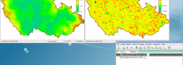
Discover the world of geographic data analysis with Grass GIS, a powerful software developed by the GRASS Development Team. This Windows 10 compatible tool is a gateway to advanced geospatial technologies, offering a comprehensive suite of raster, vector, and geospatial processing tools. Whether you're a novice or a seasoned GIS professional, Grass GIS provides an intuitive interface to facilitate your work. Dive into the world of spatial modeling, 3D visualization, and more. Explore Grass GIS today!
| Author: | GRASS Development Team |
| License: | Open Source |
| Price: | FREE |
| Released: | Jun 3, 2022 |
| File size: | 666.00 MB |
| Downloads: | 330 |
| Keywords: | analyze, Image processing, GRASS Development Team, Cartographic tools, geography, resource analysis, Geospatial analysis, geographical system, Open-source software, analysis, geographical information, Grass GIS |
| Author URL: | http://grass.fbk.eu/impressum.html |
Welcome to your one-stop destination for downloading the remarkable software, Grass GIS, developed by the esteemed GRASS Development Team. This powerful open-source Geographic Information System (GIS) is your key to handling, analyzing, and visualizing geospatial data in Windows 10.
Grass GIS is a comprehensive tool that offers over 350 modules for processing raster, topological vector, image processing, and graphics production. It's a perfect choice for professionals in the field of geospatial data analysis, environmental modeling, and spatial statistics.
The software is renowned for its robustness, reliability, and versatility, making it a favorite among researchers, students, and professionals alike. It supports both 2D and 3D raster data, including time series, and provides advanced capabilities like voxel-based analysis and network analysis.
Grass GIS is a product of the collective effort of a global team of developers who have worked tirelessly to ensure it remains at the forefront of GIS software. It's continuously updated, ensuring users always have access to the latest features and improvements.
Experience the power of Grass GIS and unlock the full potential of your geospatial data. Download it today and join the community of users who trust Grass GIS for their data analysis needs.