Global Mapper x64
Global Mapper is a geographic information system (GIS) for working ... which areas are visible from a chosen location. Global Mapper can reproject, crop and merge raster and elevation ...

Global Mapper is a GIS application for viewing, editing, analyzing, and converting spatial data. It combines raster, elevation, and vector layers in a shared map workspace, with tools to reproject, crop, mosaic, and export datasets. Terrain features include contour generation, elevation queries, viewshed and watershed analysis, and cut-and-fill calculations. It also supports 3D viewing, vector digitizing, GeoPDF, scripting, and batch conversion.
| Author: | Blue Marble Geographics |
| License: | Demo |
| Price: | $499.00 |
| Released: | Feb 15, 2024 |
| File size: | 184.00 MB |
| Downloads: | 555 |
| Keywords: | Blue Marble Geographics, GIS data, data production, elevation data viewer, raster data converter, geographic, terrain analysis tool, spatial data processing, gheography, geographical, create contour maps, gis mapping software, geographical data, geospatial data editor, terrain analysis, 3D data visualization, Global Mapper, GIS software |
| Author URL: | https://www.bluemarblegeo.com/ |
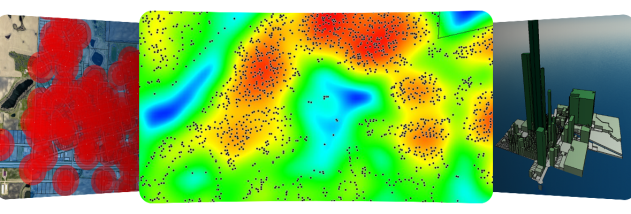

Global Mapper is a geographic information system (GIS) for viewing, analyzing, editing, and converting spatial data. It is suited to GIS professionals, surveyors, planners, researchers, and other users who work with maps, terrain, imagery, or 3D data. Its layer-based workspace can bring together datasets such as digital elevation models, scanned maps, aerial imagery, and vector features, making it easier to inspect how different sources relate to one another.
The application handles raster, elevation, and vector data in a shared map workspace. Users can change a dataset's projection to match a project, crop it to an area of interest, or convert its format during export. Multiple raster or elevation datasets can be merged into a mosaic, with their positioning information used to place them relative to one another. These tools help prepare incoming data for analysis or for use in other mapping applications.
For terrain work, Global Mapper can create contours from surface data, query elevations, compare terrain layers, and calculate cut-and-fill volumes. It also supports line-of-sight and viewshed analysis, including Fresnel viewsheds, as well as watershed delineation. Raster tools include blending, feathering, spectral analysis, and contrast adjustment. Three-dimensional point data can be triangulated or gridded, while the 3D viewer displays elevation and vector data and can drape imagery or other map layers over the surface.
Users can digitize point, line, and area features with the mouse and edit existing vector features, then save their work in supported export formats. The program can combine data in a 3D map, produce printable results, or export a high-resolution raster image for reports and presentations. It can also import GeoPDF files and export map data as Geo-enabled PDFs. A built-in scripting language and batch conversion tools provide ways to automate repeated processing tasks.
Global Mapper includes direct access to supported online imagery and map sources, including OpenStreetMap, WMS services, and named elevation and imagery datasets. Online source availability may depend on the service. The software is distributed as a demo and is available for Windows 10 and Windows 11. Its projection, conversion, analysis, and export tools support workflows ranging from preparing survey data to producing terrain studies and map figures.