Patent Grabber
Patent Grabber is a Windows utility for researchers, inventors and ... patent or application numbers and start a batch download. The program retrieves the available pages and saves ...

Universal Maps Downloader saves map tiles from supported online services, including Google Maps, Bing Maps, and OpenStreetMap. Users define an area with geographic coordinates, choose a zoom level and map type, then download tiles individually or in bulk. The program can join tiles into a larger image, export JPEG, PNG, or BMP files, and calibrate or georeference maps for GIS workflows. It is offered as a demo for Windows.
| Author: | allmapsoft.com |
| License: | Demo |
| Price: | $69.00 |
| Released: | Oct 2, 2026 |
| File size: | 25.70 MB |
| Downloads: | 837 |
| Keywords: | satellite imagery download, download, map downloader, grabber, bulk map download, Universal Maps Downloader, merge map tiles, allmapsoft.com, map, download map, map retrieval, x64 software, georeference maps, offline map images, download map tiles, map grabber, offline map access |
| Author URL: | https://www.allmapsoft.com/ |
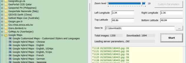


Universal Maps Downloader is a Windows application for saving map imagery from supported online map services. It is intended for travelers preparing offline references, map enthusiasts building image collections, and GIS users who need map images for further work. Users choose a geographic area and map settings, then download the corresponding map tiles to the computer.
The download setup uses geographic coordinates, zoom level, and map type to define the coverage and appearance of a map. Depending on the selected source, available imagery can include street, satellite, terrain, or hybrid views. Support for services such as Google Maps, Bing Maps, and OpenStreetMap gives users a choice of map sources rather than limiting a project to a single provider. Bulk downloading can cover a larger area in one operation, which is useful when preparing maps for a route, region, or other defined location.
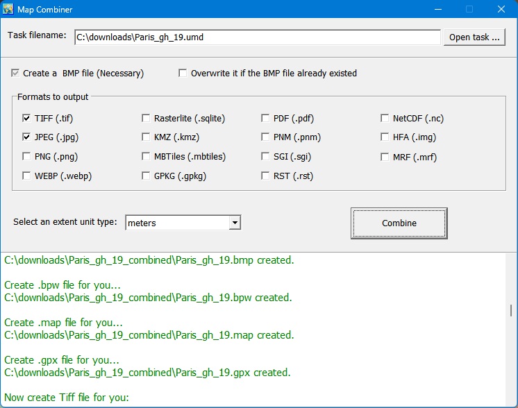
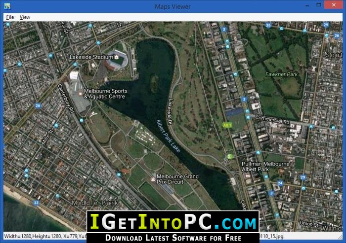
Downloaded tiles can be combined into a larger image, creating a continuous view across the selected area. This is useful when an individual tile is too small for reference, printing, or import into another application. Output options include JPEG, PNG, and BMP, so the resulting image can fit common image-editing and document workflows. Map calibration and georeferencing tools help users associate an image with spatial coordinates when it will be used in GIS work; they are distinct from simply joining tiles into a picture.
Typical uses include assembling a regional map for trip planning, keeping a local image reference when internet access is unavailable, collecting map imagery for study, and preparing images for GIS or other software. The level of detail depends on the chosen zoom and source, while the selected coordinates determine the area covered. Users should check the terms and access rules of each map service before downloading or reusing its imagery, particularly for large projects or redistribution.
Universal Maps Downloader is commercial software offered as a demo, and runs on Windows 10 and Windows 11, as well as earlier Windows versions. Its interface brings the area and download settings together, making the basic process accessible without requiring a GIS background, while its bulk, merge, and georeferencing features support more involved workflows. The program is designed to save map images locally; it is not a replacement for a live navigation service.