GPSMapEdit

GPSMapEdit 2.1.78.18

Designed for visual authoring of GPS-maps

GPSMapEdit will help you work with Garmin MapSource, Polish format (input files for cGPSmapper.exe), ALAN Map 500/600, Holux, Navitel Navigator (Pocket PC navigation software). GPSMapEdit offers useful features for helping users manipulate geographical data in a clean environment and is suitable for beginners and professionals alike.

GPSMapEdit 2.1.78.18 details

Author:
License: Demo
Price: $45.00
Released:
File size: 3.80 MB
Downloads: 296
Keywords: GPS Map, Google Map, Map Editor, GPS, Map, Editor, edit map, map viewer
Author URL: https://www.geopainting.com/
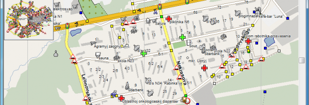
GPSMapEdit screenshot
GPSMapEditOtherWindows XP, Windows Vista, Windows Vista x64, Windows 7, Windows 7 x64, Windows 8, Windows 8 x64, Windows 10, Windows 10 x64

User Rating: 2.9 (30 votes)

Windows 10

x32

Windows 10

x64

GPSMapEdit for Windows 10 - Full description

The GPSMapEdit software was designed for visual authoring of GPS-maps in various proprietary cartographic formats. GPSMapEdit is a lightweight application designed to help you view and check out the contents of GPS maps in various cartographic formats. Other important options worth mentioning enable users to import information from MDB, SHP, MIF, CSV, or OV2 file formats, create a favourites list, rotate objects, create points, trim the map, measure the distance between points, remove duplicates and routing nodes, convert labels, merge inner polygons, edit postal address, and reset external nodes.

This software is designed for visual authoring of GPS-maps in various cartographic formats:

Polish format,
Garmin BaseCamp/MapSource,
Google Earth
Lowrance MapCreate,
CityGuide (navigation software for Android, iPhone, Windows Mobile),
Navikey 7 Ways · Navitel Navigator 3.x · ALAN Map 500/600, Holux MapShow.
and custom POIs and speedcams for:

Garmin POI Loader · iGO · TomTom OV2 · Navitel Navigator · CityGuide.
The program may also load and convert GPS-tracks, waypoints and routes in various formats:

GPX · KML/KMZ · Garmin · iGO 8 · iGO Primo · Lowrance · Magellan · Nokia · OziExplorer · ALAN · Holux.
Other supported formats are:

ECW · MrSID · JPEG 2000 · JPG · BMP · GIF · PNG · TIFF · EXIF · Google Maps · ESRI shapefile · MapInfo MIF/MID · CSV · XLS · DBF · MDB

GPSMapEdit for Windows 10 - Post your review