CAD .NET
Discover the power of CAD .NET, an innovative software solution developed by CADSoftTools, designed to seamlessly integrate CAD capabilities into your Windows 10 applications. This robust ...

LISCAD, developed by LISTECH, is a powerful software solution designed for surveying, civil engineering, and land development professionals. This comprehensive tool streamlines data management, offering advanced features for 2D and 3D modeling, terrain analysis, and CAD integration. With its user-friendly interface, LISCAD enhances productivity and accuracy in project workflows. Whether you're processing survey data or generating detailed plans, LISCAD equips you with the essential tools to elevate your work. Experience precision and efficiency like never before with LISCAD!
| Author: | LISTECH |
| License: | Trialware |
| Price: | FREE |
| Released: | Nov 27, 2025 |
| File size: | 160.00 MB |
| Downloads: | 6 |
| Keywords: | geodetic, data visualization, mapping, geospatial, download LISCAD, terrain modeling, engineering tools, surveying software, LISCAD free download, geodetic coordinate, CAD, land survey processor, engineering, process, geospatial analysis, coordinate, data processing, CAD integration, surveying, LISCAD, create 3D visualization, visualization |
| Author URL: | https://listech.com/products/liscad |
Discover LISCAD, the premier software solution from LISTECH designed for surveying and civil engineering professionals. This powerful application offers a comprehensive suite of tools tailored for land surveying, mapping, and data analysis, making it an essential asset for any project. With its intuitive interface, LISCAD streamlines complex workflows, allowing users to efficiently manage and visualize spatial data.
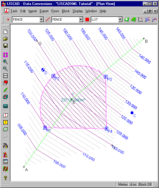
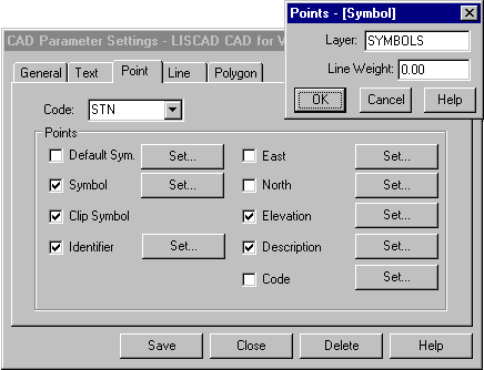
LISCAD supports a wide range of file formats, ensuring seamless integration with existing systems and enhancing collaboration among teams. Its advanced features, including 3D modeling, contour generation, and precise calculations, empower users to deliver accurate results with confidence. Whether you're working on large-scale infrastructure projects or detailed land surveys, LISCAD provides the versatility and precision you need.
Elevate your surveying capabilities and experience the difference with LISCAD—where innovation meets reliability in the world of geospatial software. Download it today and transform your workflow!