WXtrack for Windows 10 - Full description
WXtrack is a satellite-orbit prediction program for people receiving weather satellite transmissions. It calculates where satellites will travel over the Earth and predicts the images they may produce while scanning the ground. These predictions help observers identify which satellite pass they are receiving, particularly when cloud cover or signal interference makes an image difficult to interpret.
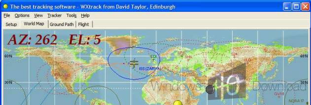
The program displays predicted satellite paths as ground tracks, showing where an orbit passes relative to locations on Earth. It also predicts the image footprint created as a satellite scans the surface, providing a visual guide to the areas represented in a received image. These two views help distinguish a satellite's route from the swath of ground captured by its sensors.
For image comparison, WXtrack can read processed satellite pictures from one or more folders selected by the user. It places those images alongside the predicted ground track, making it easier to compare observed images with the forecast pass. Predicted images include minute markers aligned with those used in NOAA APT transmissions, so observers can match points in a received picture to times during the pass.
WXtrack is intended for amateur satellite monitoring, especially weather satellite reception and analysis. It can assist with identifying observations affected by poor weather or interference, and with comparing a received image against the satellite's predicted route and scan. The core orbit-prediction functions are also available as a component for use in other software, extending the program's calculations to custom applications.
The program is offered as a demo and is free for amateur use; registration is intended for users seeking technical support or wishing to contribute. Its graphics are best suited to a display resolution of 1024 × 768, though it can run at 800 × 600. WXtrack is a Windows desktop application for satellite tracking and image correlation.