TNTatlas
Welcome to the ultimate destination for Windows 10 users seeking a powerful geospatial software solution. Introducing TNTatlas, a cutting-edge creation by MicroImages, Inc. This remarkable software ...

Welcome to the official download page for TNTmips, a cutting-edge Windows 10 software developed by MicroImages, Inc. TNTmips empowers users with a comprehensive suite of geospatial tools, enabling seamless analysis, visualization, and management of spatial data. With its user-friendly interface and robust functionality, TNTmips is the go-to solution for professionals in fields like geology, geography, environmental science, and more. Experience the power of TNTmips today and unlock the full potential of your spatial data.
| Author: | MicroImages, Inc. |
| License: | Freeware |
| Price: | FREE |
| Released: | Apr 4, 2024 |
| File size: | 121.00 MB |
| Downloads: | 675 |
| Keywords: | analyze geodetic data, GIS data analysis, TNTmips, Windows 10, dataset, editor, GIS, edit GIS dataset, software review, Inc., versatile, analysis, MicroImages, x64 |
| Author URL: | https://www.microimages.com/ |
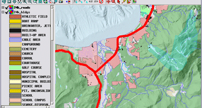
Welcome to the download page for TNTmips, an exceptional Windows 10 software developed by MicroImages, Inc. TNTmips is a powerful geospatial analysis tool that empowers users to explore, manipulate, and visualize spatial data with unparalleled precision. With its user-friendly interface and extensive functionality, TNTmips is the go-to software for professionals in fields such as geology, geography, environmental science, and more. Seamlessly integrating advanced mapping, image processing, and data analysis capabilities, TNTmips offers a comprehensive solution for all your geospatial needs. Enhance your productivity and unlock the full potential of your data with TNTmips. Download now and experience the cutting-edge features and tools that make TNTmips the ultimate choice for Windows 10 users.