Garmin POI Loader
... custom points of interest to a compatible Garmin GPS device. It is useful for adding places that are missing from the device's existing map data, including restaurants, campsites, shopping centers, swimming pools ...

OziExplorer lets users work with scanned or purchased digital maps, plan trips, and exchange GPS data. It creates waypoints, routes, and tracks on maps, and supports transferring them to and from many Garmin, Magellan, Lowrance/Eagle, Brunton/Silva, and MLR receivers. With a GPS connected, moving-map mode plots position, provides route guidance, and can change maps automatically. It also supports multiple map formats, datums, projections, and grid systems.
| Author: | Des & Lorraine Newman |
| License: | Demo |
| Price: | $95.00 |
| Released: | Feb 11, 2016 |
| File size: | 8.40 MB |
| Downloads: | 395 |
| Keywords: | Des & Lorraine Newman, gps route planner, map, GPS mapping software, explorer, Windows 10 compatible, waypoint route tracks, track recording, GPS explorer, GPS position, GPS utility, gps data transfer, GPS, gps mapping software, digital map navigation, route planning, OziExplorer, moving map gps |
| Author URL: | https://www.oziexplorer4.com/ |

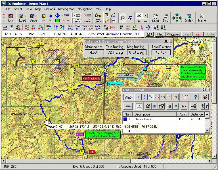


OziExplorer is a mapping and GPS navigation program for working with scanned or digitally purchased maps on a computer. It is suited to people planning trips, reviewing GPS data, or navigating with a laptop connected to a supported receiver. Rather than supplying maps, it lets users load their own map files and relate them to GPS positions and recorded or planned travel.
Trip planning takes place directly on the map. Users can mark waypoints, connect them into routes, and create tracks, then transfer these items to a compatible GPS receiver. Data recorded on a receiver can also be downloaded and displayed over a map, making it possible to inspect a journey or use existing GPS information when preparing a new route. OziExplorer supports direct waypoint, route, and track transfers with many Garmin, Magellan, Lowrance/Eagle, Brunton/Silva, and MLR receivers.
When a laptop is connected to a GPS device, moving-map mode plots the current position on the loaded map. During route navigation, the program provides guidance as each waypoint is reached and displays information such as speed, course, distance to the next waypoint, cross-track error, estimated time en route, and estimated time of arrival. It can switch to the next map automatically when the current map no longer covers the position, helping maintain map coverage while travelling.
Maps can be scanned by the user or obtained in supported digital formats, including BSB, USGS DRG, ECW, SID, TIF, and PNG. The program also supports more than 100 map datums, along with multiple map projections and grid systems, so map coordinates can be handled in different geographic reference systems. Users can add symbols and comments, define permanent map features, and attach pictures or other files to those features. Maps and waypoint lists can be printed for use away from the computer.
OziExplorer is offered as demo software and is intended for Windows computers, including Windows 10 and Windows 11. It works with maps supplied by the user; it does not upload maps to GPS receivers. GPS transfer and live tracking depend on a supported receiver and a connected computer, while the ability to use a particular map depends on its format and calibration. This makes the program useful both for desktop route preparation and for computer-based navigation in the field.