TatukGIS Viewer

TatukGIS Viewer 5.71.0

"Explore GIS Data with TatukGIS Viewer on Win10!"

Experience the power of GIS at your fingertips with TatukGIS Viewer, an exceptional software developed by TatukGIS Sp. z o. o. This Windows 10 compatible software offers an intuitive interface for viewing, querying, and analyzing geospatial data. It supports a wide range of vector, image, grid, and SQL database formats, making it a versatile tool for all your GIS needs. With its advanced features and seamless performance, TatukGIS Viewer is your go-to solution for comprehensive GIS data management. Explore the world of GIS with TatukGIS Viewer today!

TatukGIS Viewer 5.71.0 details

Author:
License: Freeware
Price: FREE
Released:
File size: 120.00 MB
Downloads: 198
Keywords: raster image Viewer, GIS mapping software, advanced geospatial functionality, viewer, GIS editor, multi-format compatibility, GIS map, TatukGIS Viewer, view, graphic, spatial data visualization, robust data handling
Author URL: https://www.tatukgis.com/
TatukGIS Viewer screenshot
TatukGIS ViewerOtherWindows XP, Windows Vista, Windows Vista x64, Windows 7, Windows 7 x64, Windows 8, Windows 8 x64, Windows 10, Windows 10 x64, Windows 11

User Rating: 0 (0 votes)

Windows 10

x32

Windows 10

x64

TatukGIS Viewer Awards

Windows 10 download editor's pick

TatukGIS Viewer for Windows 10 - Full description

Welcome to the download page for TatukGIS Viewer, an innovative software developed by TatukGIS Sp. z o. o. This powerful tool is designed for Windows 10 users who require a comprehensive solution for managing, analyzing, and editing GIS data. TatukGIS Viewer offers an intuitive interface and a robust set of features that make it a standout choice for both professionals and hobbyists in the GIS field.


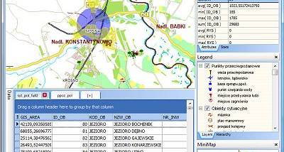
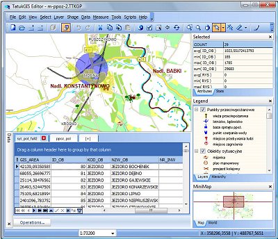
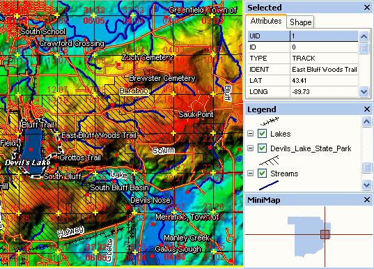
With TatukGIS Viewer, you can effortlessly view and analyze a wide range of GIS data formats. The software supports over 160 raster, vector, and database formats, ensuring compatibility with virtually any GIS project. Additionally, it provides advanced features like thematic mapping, spatial querying, and topological analysis.


The software is renowned for its speed and performance, handling large datasets with ease. It's also highly customizable, allowing you to tailor the interface and functionality to suit your specific needs. Whether you're a seasoned GIS professional or just starting out in the field, TatukGIS Viewer offers a reliable, user-friendly solution for all your GIS viewing needs. Experience the power and versatility of TatukGIS Viewer today!

TatukGIS Viewer for Windows 10 - Post your review